

Description
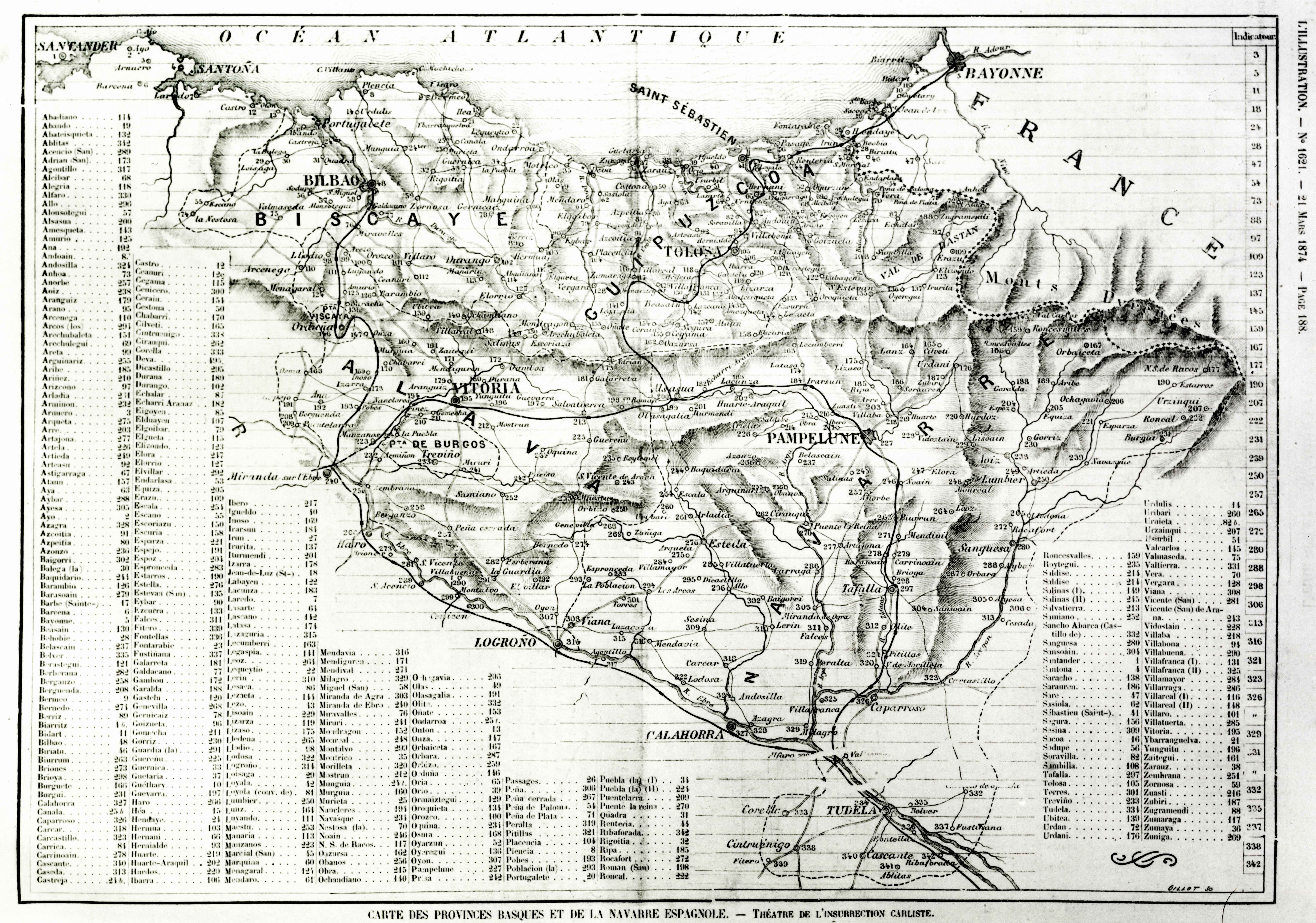
European illustrated magazines flourishing during the second half of the 19th century followed war in the Basque area with enthusiasm. This map published in the French weekly L’Ilustration describes the peninsular Basque Country with local detail, allowing its readers to track the developments of the conflict.
![Europa, das ein drittheil der erden, nach gelegenheit unserer zeit beschrieben[Sebastian Münster][Henricus Petri][Basilea] [1588]](https://imagovasconiae.eus/wp-content/uploads/2024/03/11-1-300x168.jpg)
![[Europa/ Lehendabiziko Liburuko lehendabiziko panela][Johann Stumpf][Christoffel Froschouer][Zurich] [1548]](https://imagovasconiae.eus/wp-content/uploads/2024/03/15-1-300x232.jpg)
![[Hispania]Paulo di ForlaniF. Bertelli[Venezia] [1560 inguru]](https://imagovasconiae.eus/wp-content/uploads/2024/03/17-1-300x252.jpg)
![[Europa][Heinrich Bünting][Z. Krafft][Wittenberg] [1587 inguru]](https://imagovasconiae.eus/wp-content/uploads/2024/03/28-1-300x214.jpg)
