

Description
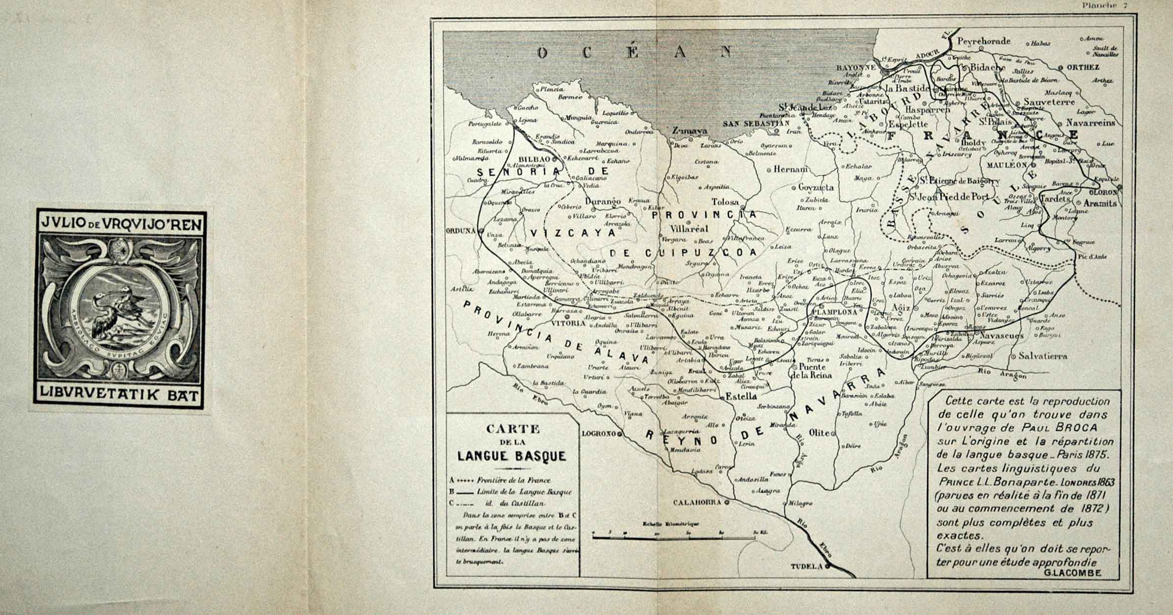
Sometime after Bontaparte’s monumental linguistic map, a myriad of maps emerged showing the boundaries of Basque language. Paul Broca’s map was later reedited by Lacombe, a linguist from Lower Navarre. In 1882, another map appeared in the book Les Basques et le Pays Basque authored by Vinson, with the language’s boundary reaching the north of Tafalla.
![[Espainia][Diogo Homen]Eskuizkribualeku gabe [1559]](https://imagovasconiae.eus/wp-content/uploads/2024/03/22-1-300x224.jpg)
![Tabula Secunda Europe [Martin Waldseemüller][Joannes Schott][Estrasburgo] [1513]](https://imagovasconiae.eus/wp-content/uploads/2024/03/7-1-300x201.webp)
![De Hispania: Hispaniae descriptio secundumregna eius, prouincias fluuios & ciuitates[Sebastian Münster][Henricus Petri][Basilea] [1550 inguru]](https://imagovasconiae.eus/wp-content/uploads/2024/03/16-1-300x171.jpg)
![[Mediterraneoko eta Atlantikoaren kostaldeko itsasbidea][Plácido Caloiro y Oliva]Eskuizkribual.g. [16-–]](https://imagovasconiae.eus/wp-content/uploads/2024/03/24-1-300x154.jpg)
