

Description
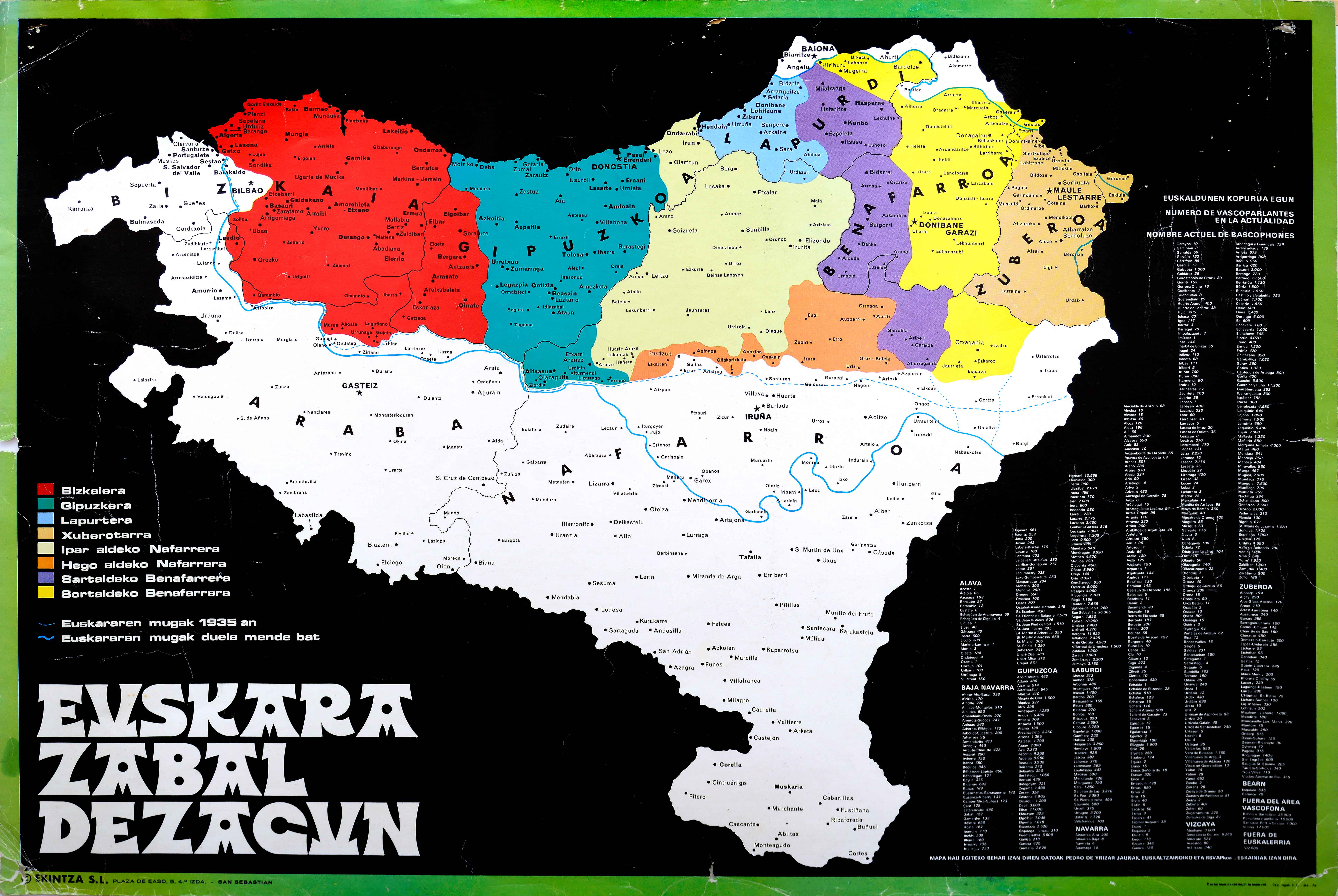
Despite Franco’s dictatorial regime, maps of the Basque Country continued to be published. The end of the period opened up further opportunities for Basque cartography, including this map of the Basque language, drawn up with the support of Pedro Yrizar, member of the Royal Academy of the Basque Language, Euskaltzaindia.
![[Iberiar Penintsulako eta Afrika Ipar-ekialdeko karta portulanoa] [Battista Agnese] Eskuizkribua [Venezia] [1553 inguru](https://imagovasconiae.eus/wp-content/uploads/2024/03/14-1-1-300x214.jpg)
![[Mediterraneoko eta Atlantikoaren kostaldeko itsasbidea][Plácido Caloiro y Oliva]Eskuizkribual.g. [16-–]](https://imagovasconiae.eus/wp-content/uploads/2024/03/24-1-300x154.jpg)
![Hispaniae Nova Describtio.De Integro Multis inLocis, SecundumHydrographicas, Desc. Emendata[Mercator-Hondius]Jodocus HondiusAmsterdam [1606]](https://imagovasconiae.eus/wp-content/uploads/2024/03/31-1-300x213.jpg)
![[Tabula II Europae][Laurent Fries][Joannes Grüninger][Estrasburgo] [1522]](https://imagovasconiae.eus/wp-content/uploads/2024/03/8-1-300x218.webp)
