

Description
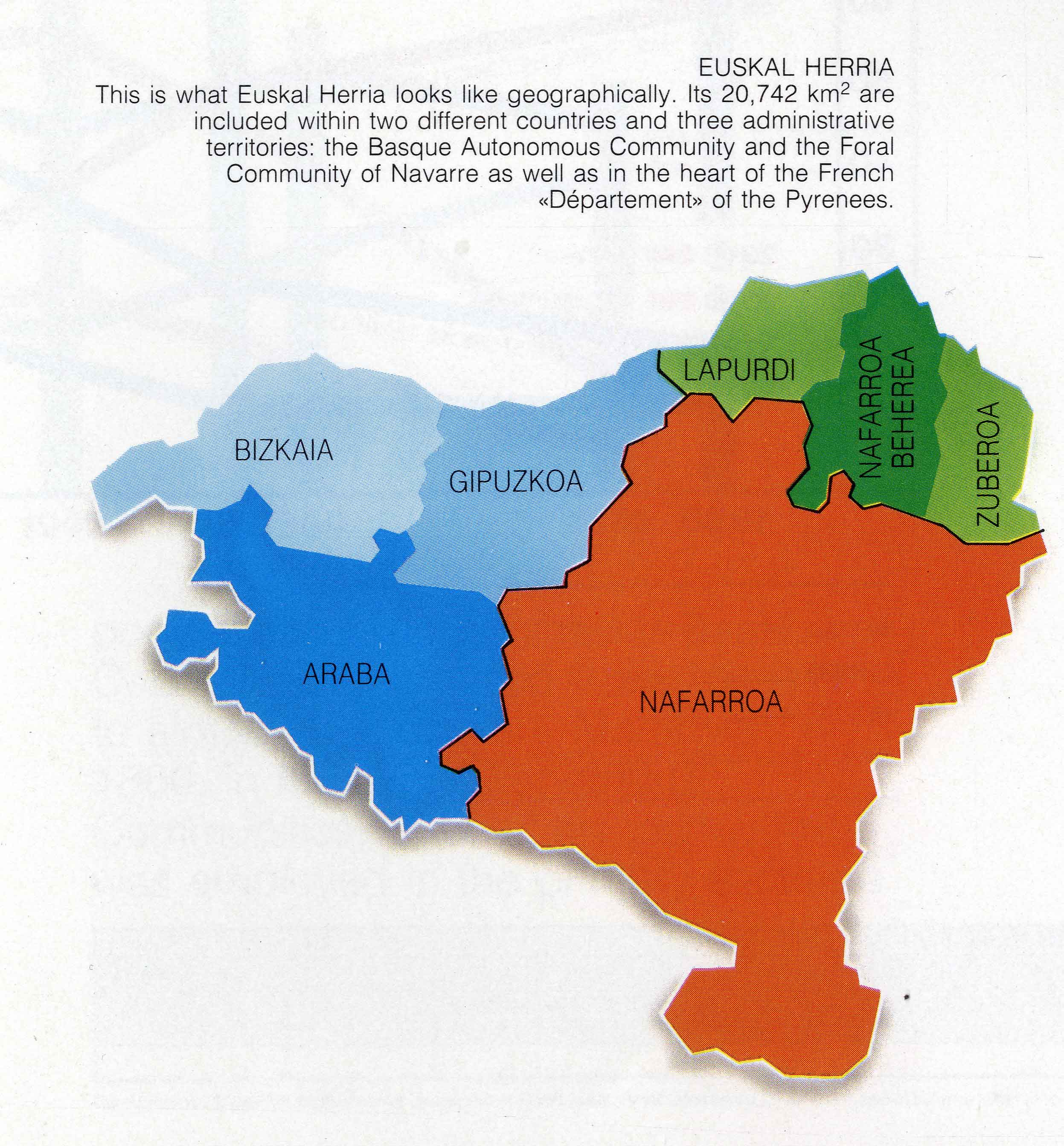
Along the lines of the dialectal maps published over the second half of the 19th century, as 20th century drew to a close, the same graphic support was used for the education of young students. Such is the case for this map provided in the didactic unit entitled Pamplona se dice Iruñea (“Pamplona is called Iruñea”), issued by the City Council. Later, in 1992, the governments of the BAC, Basque Autonomous Community, and Navarre jointly published this leaflet including the map of the Basque Country intended for foreigners and published in many languages.
![Regni Hispaniae postomnium editioneslocupletissima descriptio[Abraham Ortelius]arg. g.[Anberes] [1570]](https://imagovasconiae.eus/wp-content/uploads/2024/03/19-1-300x223.jpg)
![Hispaniae Nova Describtio.De Integro Multis inLocis, SecundumHydrographicas, Desc. Emendata[Mercator-Hondius]Jodocus HondiusAmsterdam [1606]](https://imagovasconiae.eus/wp-content/uploads/2024/03/31-1-300x213.jpg)
![Tabula Secunda Europe [Martin Waldseemüller][Joannes Schott][Estrasburgo] [1513]](https://imagovasconiae.eus/wp-content/uploads/2024/03/7-1-300x201.webp)
![De Hispania: Hispaniae descriptio secundumregna eius, prouincias fluuios & ciuitates[Sebastian Münster][Henricus Petri][Basilea] [1550 inguru]](https://imagovasconiae.eus/wp-content/uploads/2024/03/16-1-300x171.jpg)
