

Description
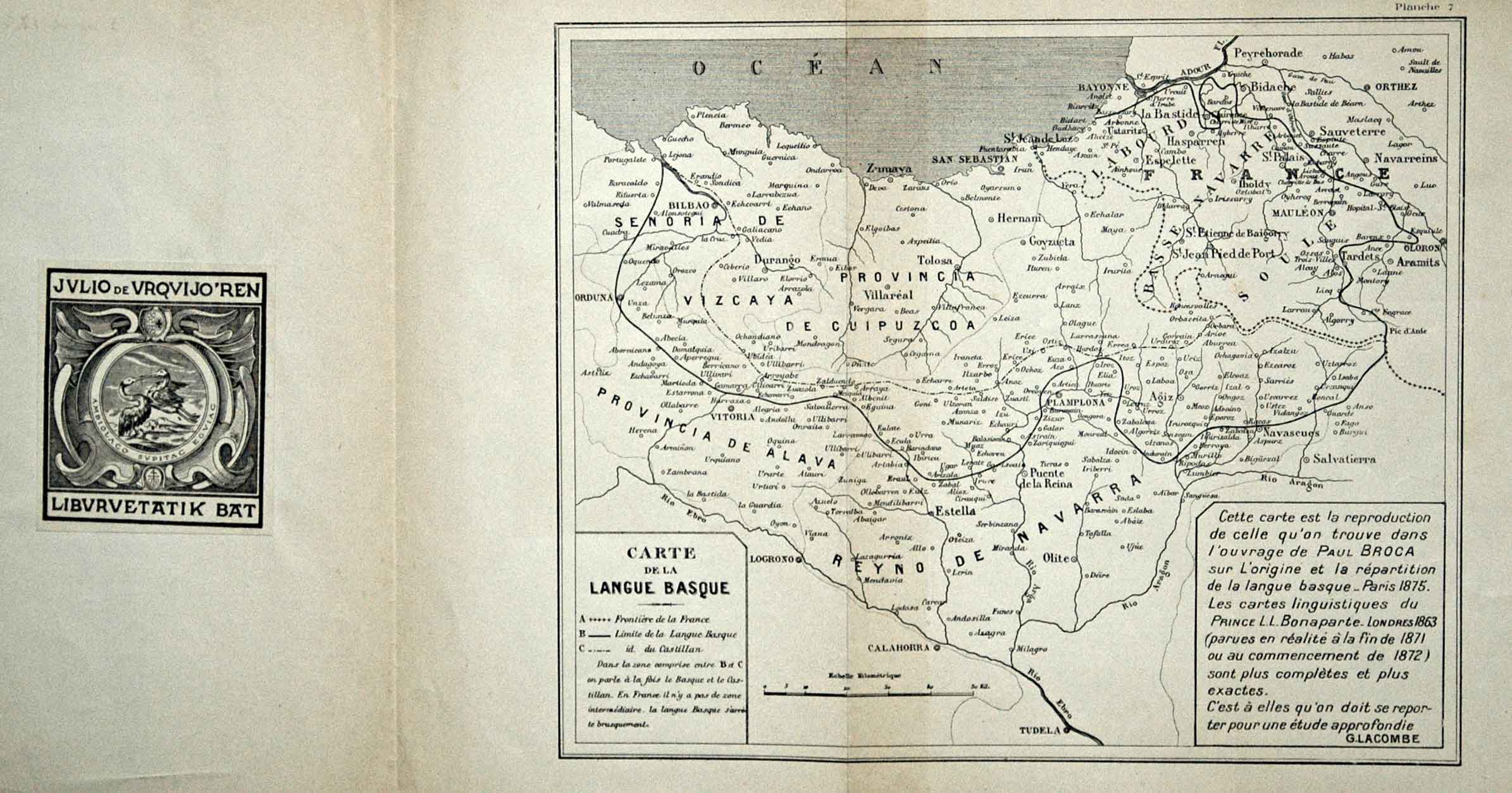
Sometime after Bontaparte’s monumental linguistic map, a myriad of maps emerged showing the boundaries of Basque language. Paul Broca’s map was later reedited by Lacombe, a linguist from Lower Navarre. In 1882, another map appeared in the book Les Basques et le Pays Basque authored by Vinson, with the language’s boundary reaching the north of Tafalla.
![Tab II Europae/Hispaniam ac Lusitaniam[Gerard Mercator][G. Kempen][Kolonia] [1578]](https://imagovasconiae.eus/wp-content/uploads/2024/03/21-1-300x231.jpg)
![[Mediterraneoko eta Atlantikoaren kostaldeko itsasbidea][Plácido Caloiro y Oliva]Eskuizkribual.g. [16-–]](https://imagovasconiae.eus/wp-content/uploads/2024/03/24-1-300x154.jpg)
![[Hispania]Paulo di ForlaniF. Bertelli[Venezia] [1560 inguru]](https://imagovasconiae.eus/wp-content/uploads/2024/03/17-1-300x252.jpg)
![[Europa/ Lehendabiziko Liburuko lehendabiziko panela][Johann Stumpf][Christoffel Froschouer][Zurich] [1548]](https://imagovasconiae.eus/wp-content/uploads/2024/03/15-1-300x232.jpg)
