

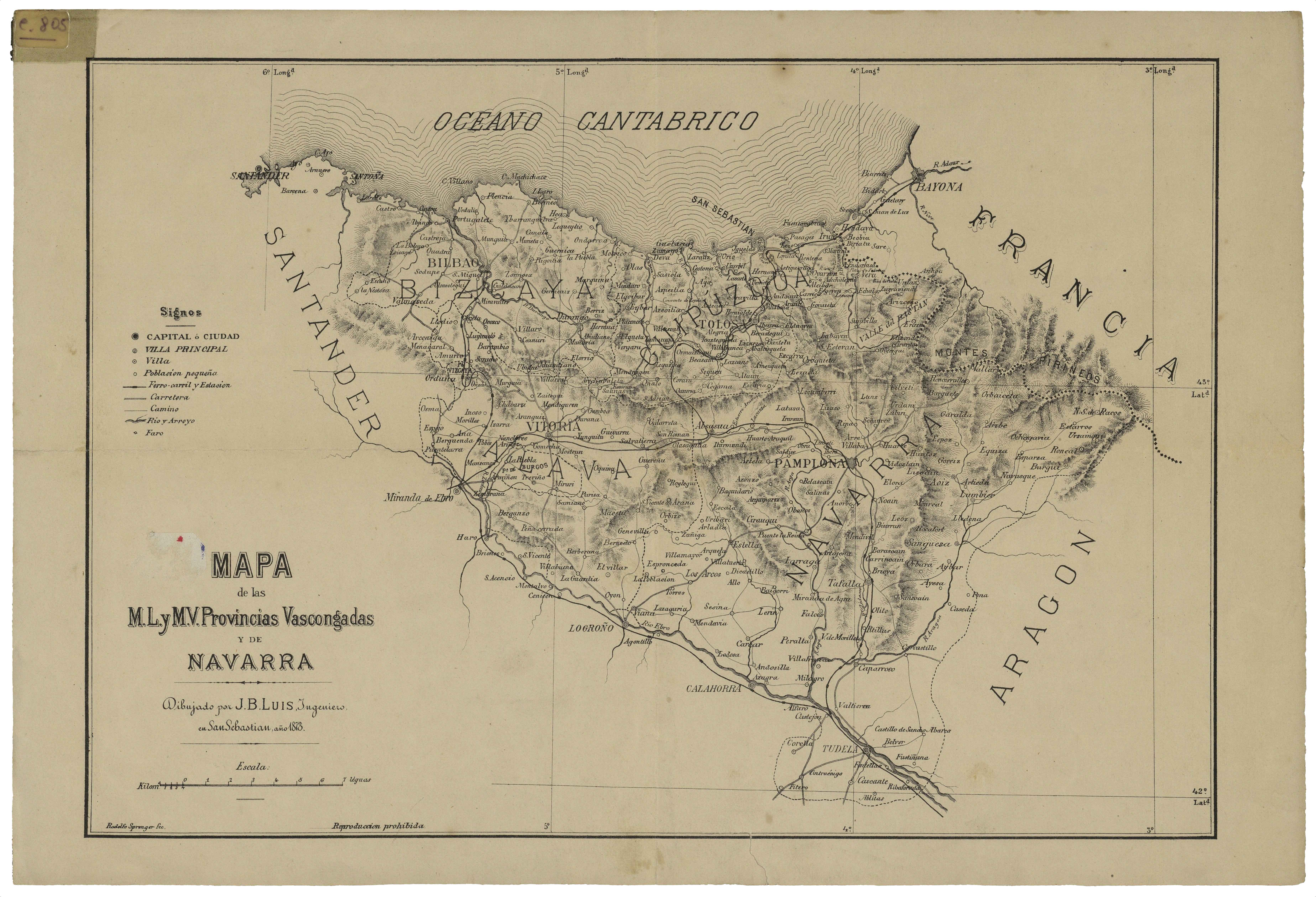
Description
Regardless of the cartography associated to events of war, the 19th century saw the issue of different local cartography items crafted by residents dwelling in the Basque area. Engineer J.B. Luis laid out a map of the whole Basque area in the Iberian Peninsula.
![Tabu[la] Nova Hispaniae [Laurent Fries] [Miguel Servet][Melchor eta Gaspar Trechsel][Lyon] [1535]](https://imagovasconiae.eus/wp-content/uploads/2024/03/9-1-300x144.webp)
![De Hispania: Hispaniae descriptio secundumregna eius, prouincias fluuios & ciuitates[Sebastian Münster][Henricus Petri][Basilea] [1550 inguru]](https://imagovasconiae.eus/wp-content/uploads/2024/03/16-1-300x171.jpg)
![Hispania III Nova Tabula[Sebastian Münster] [Henricus Petri][Basilea] [1540]](https://imagovasconiae.eus/wp-content/uploads/2024/03/13-1-300x234.webp)
![HispaniaEg. g.Arg. g[XVI. mendea]](https://imagovasconiae.eus/wp-content/uploads/2024/03/5-1-300x246.webp)
