

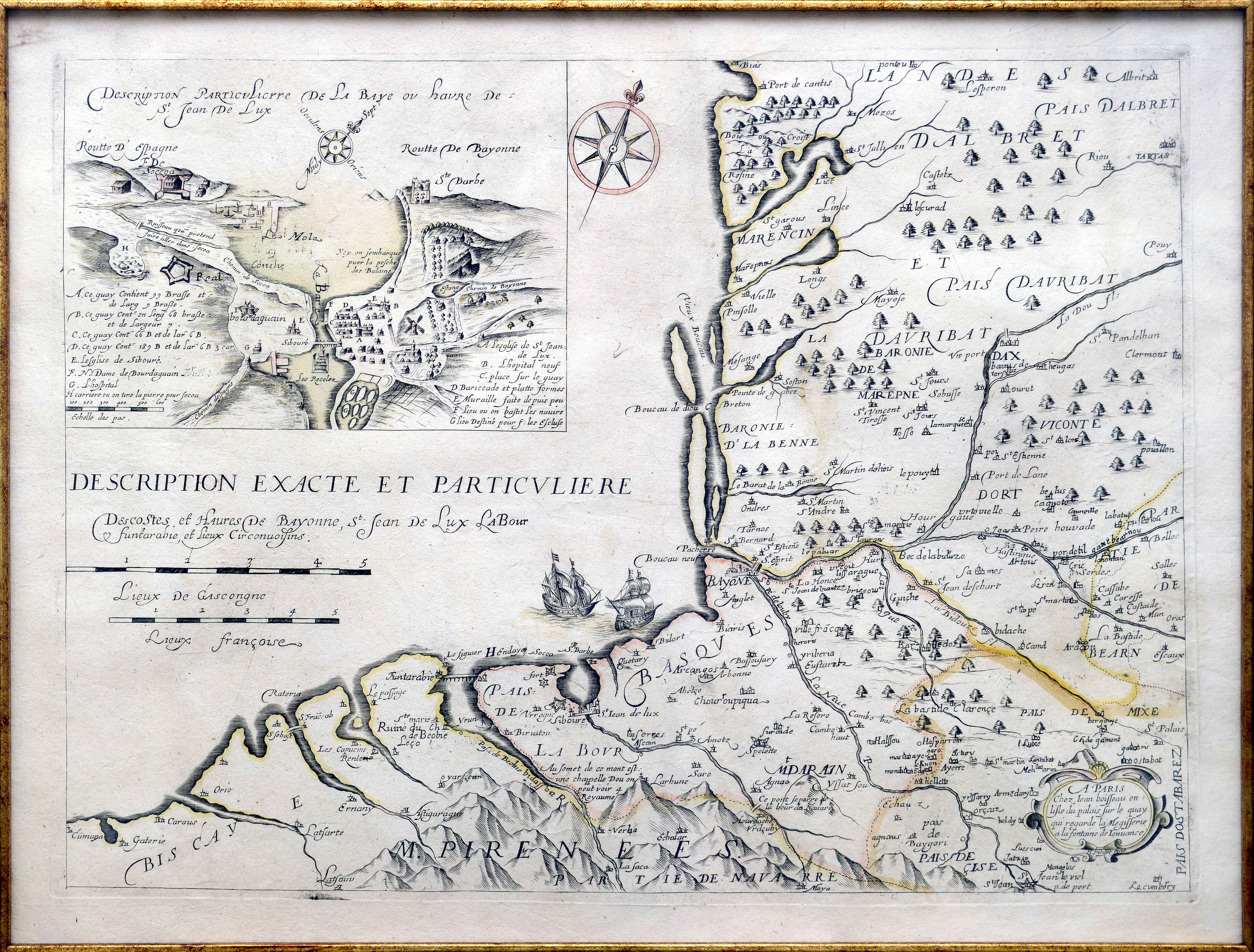
Description
Printed cartography of the continental Basque Country is scarce over the 17th century. This example provides a view of the coastline, penetrating deep down into Lower Navarre. The inset of Donibane Lohizune (Saint-Jean-de-Luz) stands out for its lavish details. During the 17th century, Lagniet reprinted this map published 24 years earlier by Jean Boisseau.
![[Mediterraneoko eta Atlantikoaren kostaldeko itsasbidea][Antonio Millo]Eskuizkribua[Venezia] [1583]](https://imagovasconiae.eus/wp-content/uploads/2024/03/23-1-300x194.jpg)
![[Mapamundia][Urbano Monti]EskuizkribuaMilan [1587]](https://imagovasconiae.eus/wp-content/uploads/2024/03/27-1-300x223.jpg)
