

Description
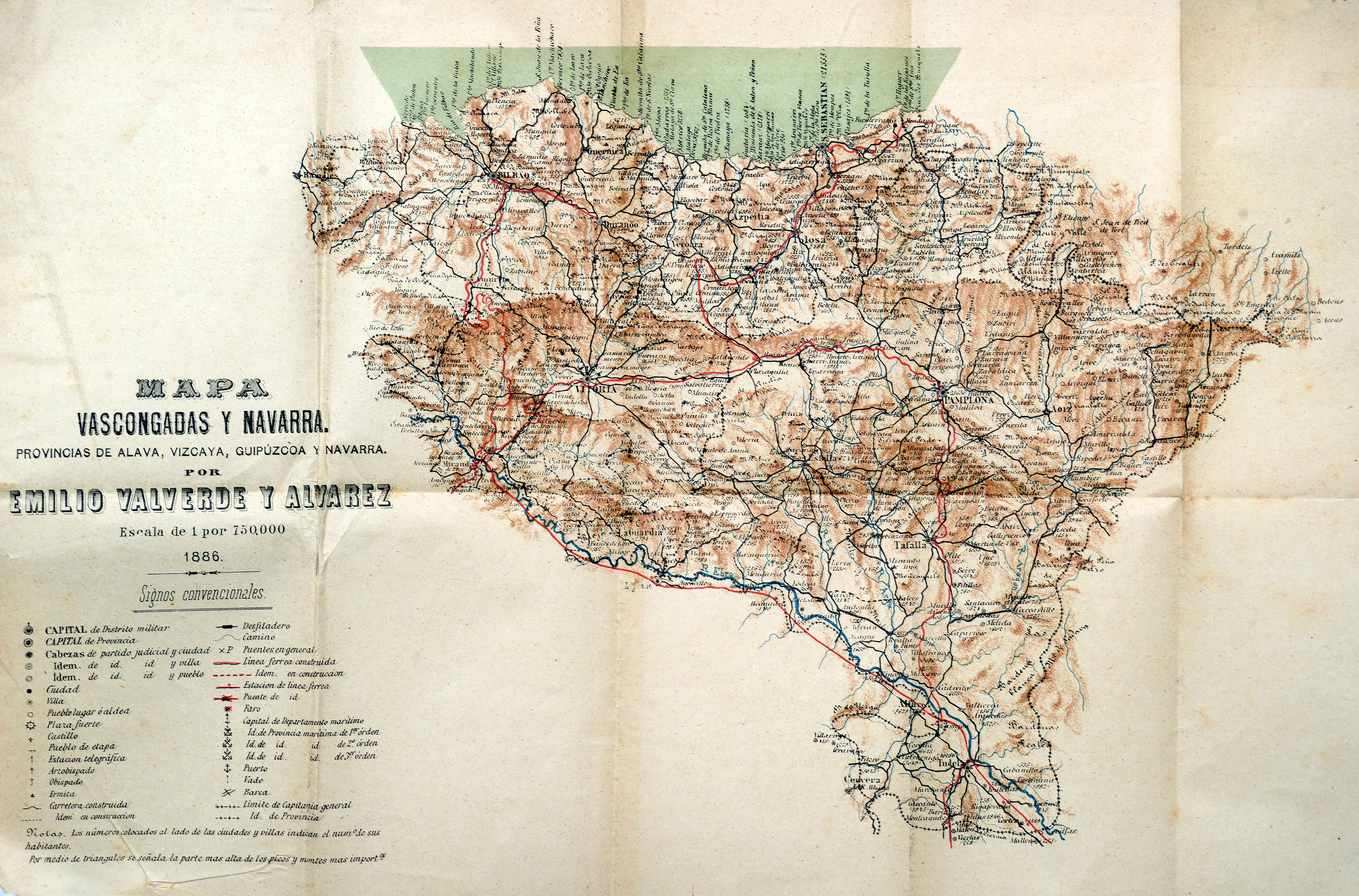
Emilio Valverde, military official and cartographer, had published in 1880 an Atlas de España y Portugal, accompanied by compelling descriptive material. The work paved the grounds for his publication of travel guides a few years later. This map went with the Guía de las Provincias Vascongadas y Navarra, published in 1886 as its general map. It stands out for describing both railway lines and roads.
![[Mediterraneoko eta Atlantikoaren kostaldeko itsasbidea][Antonio Millo]Eskuizkribua[Venezia] [1583]](https://imagovasconiae.eus/wp-content/uploads/2024/03/23-1-300x194.jpg)
![Tabula Europae II[Girolamo Ruscelli][Vincenzo Valgrisi][Venezia] [1561]](https://imagovasconiae.eus/wp-content/uploads/2024/03/18-1-300x220.jpg)
![Tabula Europae II [Sebastian Münster][Henricus Petri][Basilea] [1540]](https://imagovasconiae.eus/wp-content/uploads/2024/03/12-1-300x235.jpg)
![Evropa Prima Nova Tabvla [Sebastian Münster][Henricus Petri][Basilea] [1540]](https://imagovasconiae.eus/wp-content/uploads/2024/03/10-1-300x169.jpg)
