

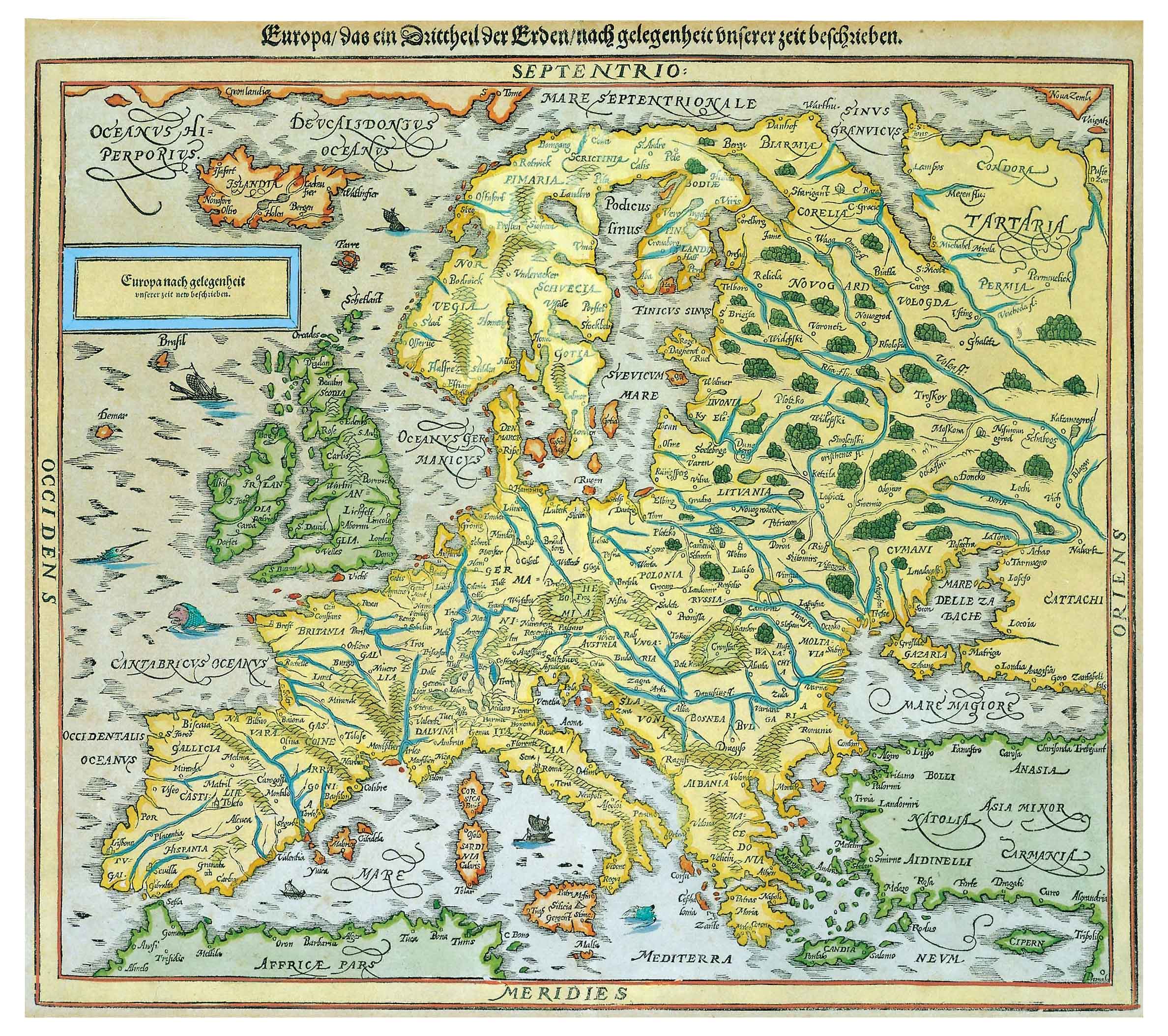
![Europa, das ein drittheil der erden, nach gelegenheit unserer zeit beschrieben[Sebastian Münster][Henricus Petri][Basilea] [1588]](https://imagovasconiae.eus/wp-content/uploads/2024/03/11-1.jpg "11-1")
Description
Münster offers since 1540 one of the earliest modern models of the European continent. Drawn up with a southern projection, an occasional map of the Iberian Peninsula presents our territory under the labels of “Gnafconia”, “Bizcaia”, “Panpalona” and “Nauarra”. The 1588 edition shows “Navarra” extending over most of the territory.
![[Mediterraneoko eta Atlantikoaren kostaldeko itsasbidea][Antonio Millo]Eskuizkribua[Venezia] [1583]](https://imagovasconiae.eus/wp-content/uploads/2024/03/23-1-300x194.jpg)
![[Europa][Heinrich Bünting][Z. Krafft][Wittenberg] [1587 inguru]](https://imagovasconiae.eus/wp-content/uploads/2024/03/28-1-300x214.jpg)
![Tabula Secunda Europe [Martin Waldseemüller][Joannes Schott][Estrasburgo] [1513]](https://imagovasconiae.eus/wp-content/uploads/2024/03/7-1-300x201.webp)
![Hispania III Nova Tabula[Sebastian Münster] [Henricus Petri][Basilea] [1540]](https://imagovasconiae.eus/wp-content/uploads/2024/03/13-1-300x234.webp)
