

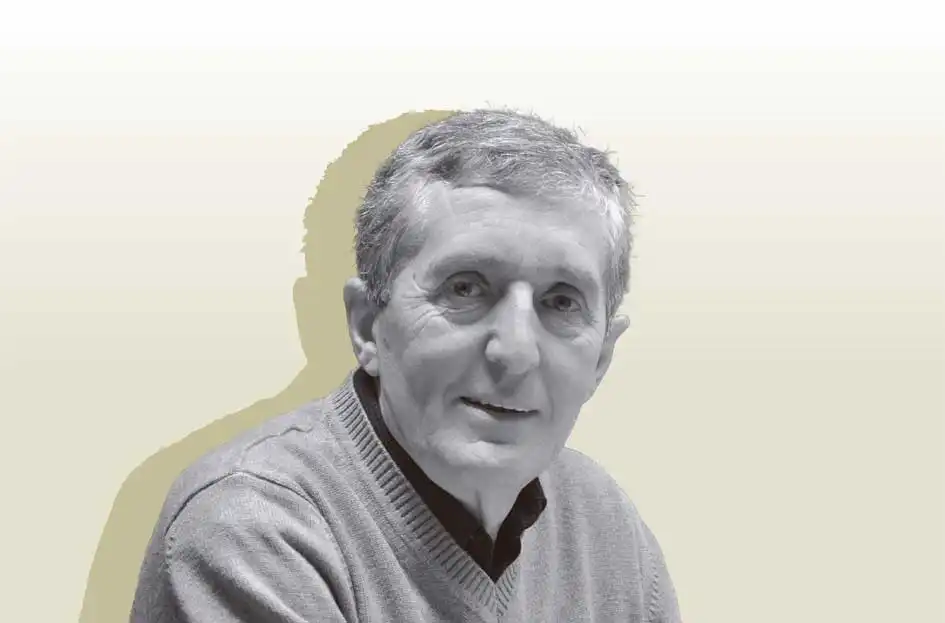
Jose Mari Esparza Zabalegi
Born in Tafalla (1951), Esparza completed a master’s degree in industrial engineering at the Salesians College in Pamplona and worked at the foundry Victorio Luzuriaga located in his home town. Since 1985, he has been an active member of the operative group behind the association Altaffaylla Kultur Taldea. He collaborated with Jimeno Jurío and edited the first books on historical memory, such as Navarra 1936, a pioneer in its genre.
Since 1988, he has directed the publishing house Txalaparta, with a catalogue of more than 1,300 books, both in Basque and Spanish. Over the last 30 years, he has promoted several magazines, associations, foundations and publishing houses. In addition, he has written or collaborated in more than 30 books related to local customs (folk song tradition, jota songs, lexicon), Basque history, political-historical essays, as well as Basque cartography.
Oral cartography
It was in 2011 that my first cartographical book came out. Back then, I expressed my bewilderment at the lack of an atlas that integrated the abundant cartography which featured the full extent of our territory, regardless of its various names, i.e Vasconia, Navarre, Basque Country, the Basque region, Basqueland or whatever other name comes to mind in English when referring to what has been called in Basque for centuries: Euskal Herria.
That first approach, undertaken with other goals and urges in mind, provided the basis to continue calling on cartographic repositories and specialised collections from all over the world, until we put together a collection on a par with many atlases, generally published under the sponsorship and patronage of universities, sovereign states, autonomous regions or major institutions.
Along the way, I had the chance to meet Ramón Oleaga, as erudite in cartography as he is passionate about his country. This Atlas is a result from this amalgamation between a Biscayan from Bilbao and a Navarrese from the Ager vasconum area, which I am confident, will set a milestone in the bibliography and cartography in our land.
A map, says my friend, professor and historian Juan Madariaga, not only represents the territory, but also produces it. Cartography transcends its mere instrumental character and often becomes a cultural artefact, fulfilling an important ideological task of internal and external identification. It is also an important indicator of how to understand the views held on a given country, in this case, ancient Vasconia, throughout history.
Hundreds of maps reveal to us cartography for the whole territory in spite of our administrative fragmentation, produced firstly by two different states, often locked in conflict, and secondly, paving the way to a variety of territorial denominations, such as the Kingdom of Navarre, the Basque Provinces, or Lower Navarre, also named Ultrapuertos. These circumstances left us wondering as to what the most suitable title for this Atlas would be. It is a country of a hundred names, as Wilhelm von Humboldt lamented back in 1805. The very first name for the country, or coronym, Wasconia, (“UUasconia”) was to be followed by many others, sometimes written on maps and with many spoken and written forms in what I have called “oral cartography”.
Thus, in the 2nd century A.D., the geographer Ptolemy identified the territory of the Vascones in his work for the first time, the earliest known ancestors of modern-day Basques. The Latin poet Prudentius, born in the Vascon city of Calagurris, or Calahorra, called the Ebro the “Basque River”. Around 393, Paulinus of Nola already referred to the Vasconiae saltus. Pliny wrote about the Vasconun Saltus while Livy about the Vasconum Ager. These two regions roughly represent the Highlands and Lowlands of Vasconia, which largely occupied the area of present-day Navarre. Ancient Vasconia stretched from the Pyrenees, with access to the sea through Hondarribia and Oiartzun, all the way down to the right bank of the Ebro, including Calahorra, and eastern La Rioja. From east to west, it extended from the lands of Huesca and Zaragoza, with towns such as Segia (Ejéa de los Caballeros) and Salduba, up to the borders of the Varduli, Caristii and Autrigones.
This Vasconia at the outset, the territory of the Vascones, later spread to all the territories occupied by Basque tribes. By the 6th century A.D., the modern-day Basque Autonomous Community, Northern Basque Country and Roman-period Aquitania Prima were also considered to be Vasconia. However, its meaning gradually shifted to denote the name of the part north of the Pyrenees, until it was reduced to the area south of the river Garonne, which became known as Vasconia, Wasconia and eventually Gascony.
On some maps, we shall see the name “Navarre” covering the whole of the territory, as noted in some ancient texts, for instance, an English document from 1190: “The land of the king of Navarre begins at a port called Huarce [Oiartzun] and extends to the waters of Castro [Urdiales, today located in the autonomous community of Kantabria], which is divided between the land of the king of Navarre and that of the king of Castile.
In 1571, the priest and writer Joanes de Leizarraga, born in the province of Lapurdi, or Labourd, mentions Heuscal-herria for the first time, which was confirmed as eusquel erria by the Alava-born Joan Pérez de Lazarraga, who lived south of the Pyrenees, at just about the same years.
In 1638, in his Notitia utriusque Vasconiae, the poet, lawyer and historian Arnaut Oihenart referred to the two Vasconias: “as for the Basques, some live in Iberia, on this side of the Pyrenees, others in Aquitaine, beyond the Pyrenees. On this side, the Navarrese live, the people of Jaca, Alava, Gipuzkoa and Biscay; beyond the Pyrenees, the Gascons and the Basques”, referring by the latter to the Navarrese from Ultrapuertos. In 1643, the work Gero, written by the Navarrese writer Pedro Axular, provided a more precise and modern description of the Basque Country: “Çeren anhitz moldez eta differentqui minçatçen baitira euscal herrian, Naffarroa garayan, Naffarroa beherean, Çuberoan, Lappurdin, Bizcayan, Guipuzcoan, Alaba-herrian, eta bertçe anhitz lekhutan”, namely, the present-day seven Basque districts “and many other places”.
In Romance languages, names for the whole territory vary from one author to another. “Kantabria (…) is the land of the Ebro, and the Ocean Sea, and the Provinces of Gipuzkoa, Biscay, Alava, and this Kingdom [of Navarre] as far as France”, wrote Antonio Chavier in Fueros del Reyno de Navarra in 1686. Miguel de Cervantes, following the usage during the period, called all Basques Biscaynes and, in his comedy La gran sultana (1615), he pointed out that Biscay is located “on the border of Navarre, [lying] next to Spain”.
Kantabria, Biscay, or Navarre. Some authors noted that all Basques were called Navarrese in the Catalan Countries, without distinction. A considerable number of maps feature Navarre covering the whole territory, a tradition that lasted at least until Sabino Arana, who left a record of it. Adding to the multiplicity of names, the Deputation of the Kingdom of Navarre, its governmental council, called in 1672 “all of the Basque Nation” as “its children and natives and those of the Most Noble Seignory of Biscay and the Provinces of Gipuzkoa and Alava”.
Throughout the 18th century, new names emerged in addition to the previous ones for the whole of the territory. In 1712, Joanes Etxeberri made an appeal to “Escual Herria and all the Basques”, adding in 1718 that “the areas presently named Basque, where Basque language is spoken, extend only over the greatest part of Upper Navarre, Lower Navarre, Zuberoa, Lapurdi, Gipuzkoa, Biscay and the province of Alava”. In 1745, Manuel Larramendi made a similar definition, proposed a new name and, for the first time, he gave it a political aim: “What reason is there for this privileged nation not to be a separate nation, a nation in its own right, a nation exempt from and independent of the others? (…) Why should three provinces of Spain, namely, Gipuzkoa, Alava and Biscay, not to mention the Kingdom of Navarre, be dependent on Castile, and three others, Lapurdi, Zuberoa and Lower Navarre, be dependent on France? Let us demand this from both, and we shall call ourselves the United Provinces of the Pyrenees”.
In 1786, Diego Lazkano translated the Ensayo sobre la nobleza de los Bascongados (“Essay on the Nobility of the Bascongados”), which accurately defined the territory: “Under the name of Bascongados today, we include the inhabitants of Upper Navarre, as well as those of Alava, Gipuzkoa and Biscay, who recognise the King of Spain, and the inhabitants of Lower Navarre, and those of Zuberoa and Lapurdi, who obey the crown of France. All these peoples have the same language, which the Castilians call Bascuenze, the French term Basque, and what the natives of the Country call Huscara or Heuscara”.
In the 19th century, the cartography of the country became more precise and abundant, in accordance with the vision provided by travellers, military figures, anthropologists and linguists. Far from becoming unified, the number of names in Romance languages for the territory expanded: “Navarre and the Basque Provinces are called the United Provinces of Spain (…) who, despite inhabiting either side of the French-Spanish border, show a totally peculiar character and aspect, distinct from France and Spain”, as set down by Wilhelm Von Humboldt in 1801.
In 1817, the French traveller and scholar, Victor Joseph Étienne Jouy provided another precise sketch of the Basque Country which, a few years later, especially after the First Carlist War, was borne out in a rich kind of cartography: “The Basques live on the opposite slopes of the western Pyrenees. The greater part of this nation is subject to Spain and make up the population of Navarre, Alava, Biscay and Gipuzkoa. The French Basques occupy a small territory along the northern Pyrenees divided into three regions named Lower Navarre [Benabarre], Zuberoa [Soule] and Lapurdi [Labour], which constitute with the Bearn the department or province of the Lower Pyrenees”.
In the same way that in this century German cartography approached us with interest and professionalism, travellers and scientists frequently wrote about the enigmatic territory of the Basques. In his book Züge durch die Hochgebirge und Thäler der Pyrenäen (Berlin, 1825), Wilhelm von Lüdemann states that “the greatest part of them recognises the sceptre of Spain, inhabiting almost exclusively the provinces of Upper Navarre, Alava, Biscay and Gipuzkoa, arranged in the form of a ring around the Bay of Biscay. The smaller territory –not exceeding 70,000 families– comprises the population of the French department of the Lower Pyrenees (…) The Basques themselves set their territory apart, which they call Hescual-herriac (…) the Basques know no homeland outside their mountains”.
The 19th century represents the period of the encyclopaedic dictionaries. In 1833, the Dictionnaire de la Conversation, compiled by Eugène Garay de Monglave, was published in Paris. The work revived a coronym then in disuse: Kantabria. As he described, “present-day Kantabria, whose population may number some 800,000 individuals, grouped on the main heights approaching both sides of the Pyrenees, is made up of seven provinces, three of which are in Spain and four in France”. He also fancifully comments that “the three Spanish provinces are Biscay, Gipuzkoa and Upper Navarre, in Basque Nafarrua, the vineyard country. The French provinces are the Labur, Laphhur-duy, solitude; Lower Navarre, in Basque, Garazi (sic), country of numerous springs; the country of Mixe, Amieuze, and Soule, Zuberoa (…) Whether they occupy the north or the south of the Pyrenees, the Basques have an appearance of a foreign colony nestled in Spanish and French provinces. Their blood, their customs, their language, their habits, erect a barrier between them and everything around them”.
The Spanish dictionaries point in the same direction: “These countries, the last remnants of the ancient Iberian race, occupy both sides of the western Pyrenees, between France and Spain, which make up a population of approximately 918,000 souls, distributed in seven provinces, with four being Spanish, and three being French”, as was explained in the 1883 Diccionario General Etimológico de la Lengua Española. Five years later, the Novísimo Diccionario Enciclopédico de la Lengua Castellana informed that the Basques “inhabit either side of the Pyrenees–the three so-called Basque Provinces, the French countries of Lapurdi and Zuberoa, as well as Upper and Lower Navarre, i.e. the Spanish and French Navarre”. Along with these definitions, this “oral cartography” crystallizes and fills in a plethora of maps that emerged during this period.
19th century Basque-language oral and written literature is not without descriptive examples such as this by the writer Jean Martin Hiribarren in 1853:
Nafarroa-Behera, Chubero, Laphurdi
Franciari citzaizcon partitetan geldi
Españiaco dire Nafarroa gora
Alaba, Guipuzcoa, Bizcaia ederra
Both the journalist and linguist Agosti Xaho and the philanthropist Anton Abbadia, or Abbadie, a major driving force behind the Floral Games, or Basque festivals, which were established in 1851, highlighted the unity of the seven traditional districts. They lay the ground for the design of the successful Zazpiak Bat, “The Seven Make One” coat of arms, by the end of the century. Both the design and the motto did not go unnoticed by the writer and firebrand from Bilbao Sabino Arana, who borrowed and expanded on the idea.
With the rise of pro-fueros (native laws and institutions) and Basque cultural movements, many Navarrese and Basques alike echoed the same description and binding ties within the territory in question: “All of us Basques from France and Spain –noted in Basque the priest and poet Grazian Adema Zaldubi in 1894–, share the same family (…) with the seven Basque countries banded together, All Seven making up just one. Lapurdi, Lower Navarre, Zuberoa, in France; Navarre, Gipuzkoa and Biscay and Alava, in Spain”.
By this time, a proper Basque cartography covering the whole of the territory was underway. This autochthonous mapping was promoted by new cultural institutions established in the country, such as Eusko Ikaskuntza, the Basque Studies Society, with the support of the provincial councils, the provincial governments. Abroad, books and travel guides disseminate the cartography and oral definitions of the Basque Country, Baskenland, Paesi Baschi, Pays Basque or other, such as this one by Romilly and Katharine Fedden: “Zaspiak-bat, l’Eskual Herria of Basque song and story. Of these, three are in France: Labourd, capital Bayonne; Basse-Navarre, capital St, Jean-Pied-de-Port; La Soule, capital Mauléon; and four are in Spain: Guipuzcoa, capital San Sebastian; Biscaye, capital Bilbao; Alava, capital Vittoria; and Navarre, capital Pampeluna” (The Basque Country, London, 1921).
Not even in times of greater centralisation and persecution of peripheral identities did the outline of the Basque Country cease to be published. As the Basque writer Pío Baroja noted in his 1953 work El País Vasco, “four are the provinces that make up the Spanish Basque Country: Alava, Gipuzkoa, Navarre and Biscay, whose respective capitals are Vitoria, Donostia, Iruñea and Bilbao. Three provinces make up the French Basque Country: Lapurdi, Lower Navarre and Zuberoa”. Similar definitions can be found among Falangist writers such as Manuel Iribarren Paternain (Navarra, ensayo de biografía, 1956) or in the work of Tudela-born José María Iribarren (Vocabulario Navarro, 1952): “Euskalerria: name given to the Basque Country; that is, Biscay, Gipuzkoa, Alava and Navarre in Spain, and Lapurdi, Benabarre (Lower Navarre) and Zuberoa in the French Basque Country. In Basque, Euskalherria means ‘people of the Euskos or Basques’”. These traditional sources were later used by the Enciclopedia Salvat (1967), the Enciclopedia Larousse (1972), the Espasa-Calpe (1994) and other knowledge repositories, all with very similar definitions.
This Atlas is dedicated to the Basque territory. An area that, at times, extends in cartography as far as Asturias and parts of La Rioja, Huesca or Béarn, and, at others, appears divided into provincial maps or political subdivisions, take, for instance, the Kingdom of Navarre, the Basque Provinces (“Vascongadas”), or the Pays Basque on the northern side of the Pyrenees. Nevertheless, in the end, it has always encompassed a people who have been perfectly defined down through the centuries, over and above the plethora of names Von Humboldt regretted, as ancient Vasconia in the Romance languages and, as Euskal Herria in its native language.