

Description
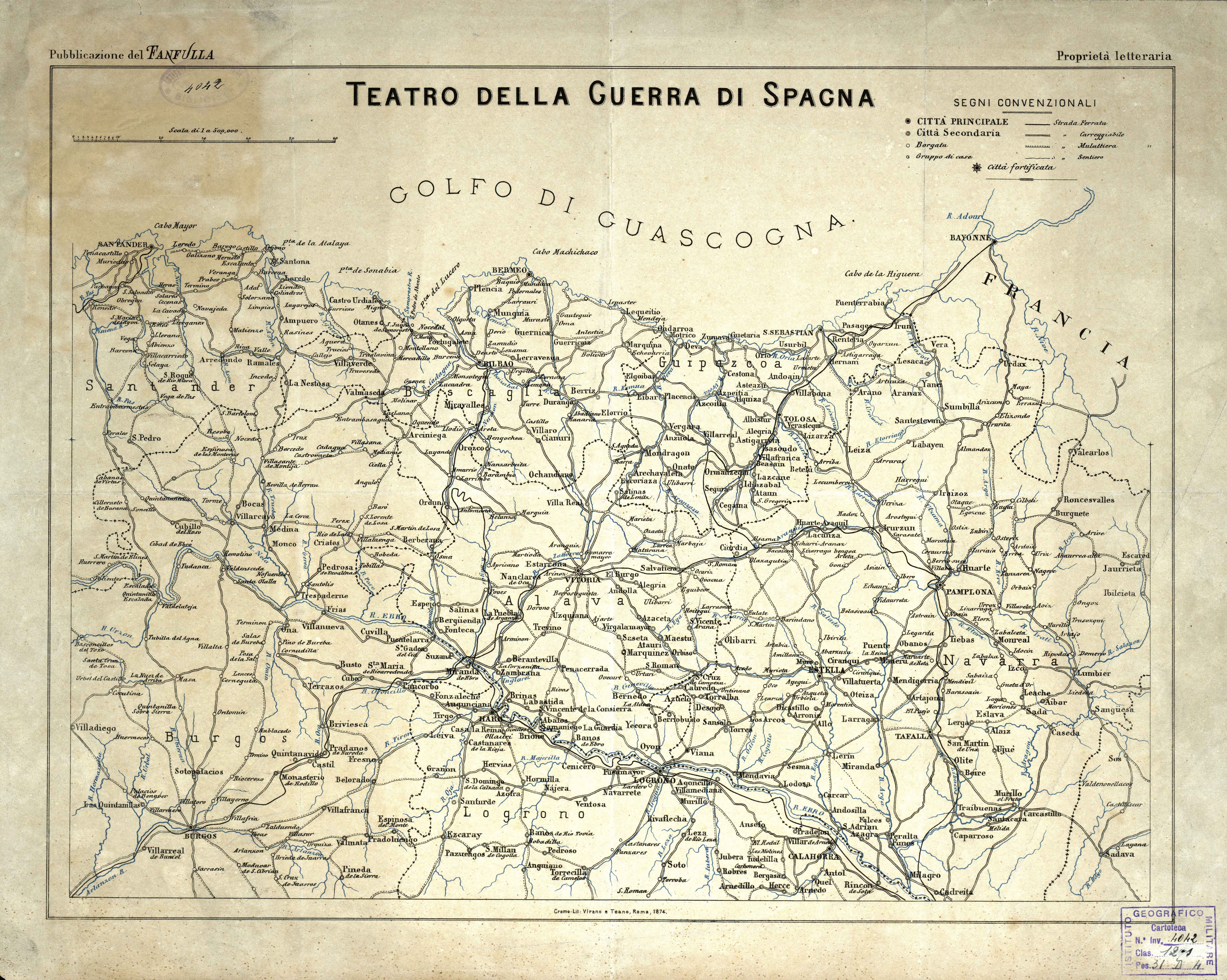
European press followed the news of the engagement in the Basque area assisted by cartographic material permitting to track the war developments. The Italian daily Fanfulla, edited back then in Rome, published in 1874 this map of the war zone.
![Tabula Europae II[Girolamo Ruscelli][Vincenzo Valgrisi][Venezia] [1561]](https://imagovasconiae.eus/wp-content/uploads/2024/03/18-1-300x220.jpg)
![[Mapamundia][Urbano Monti]EskuizkribuaMilan [1587]](https://imagovasconiae.eus/wp-content/uploads/2024/03/27-1-300x223.jpg)
![[Mediterraneoko eta Atlantikoaren kostaldeko itsasbidea][Plácido Caloiro y Oliva]Eskuizkribual.g. [16-–]](https://imagovasconiae.eus/wp-content/uploads/2024/03/24-1-300x154.jpg)
![[Europa/ Lehendabiziko Liburuko lehendabiziko panela][Johann Stumpf][Christoffel Froschouer][Zurich] [1548]](https://imagovasconiae.eus/wp-content/uploads/2024/03/15-1-300x232.jpg)
